PORT PHILLIP BAY NATIONAL PARK
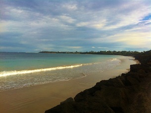 Point Lonsdale front beach
POINT LONSDALE
The waters around the Borough of Queenscliff are part the Port Phillip Bay Marine National Park.
The park is made up of six separate marine areas around the southern end of Port Phillip, two of which make up the Borough's waters: Point Lonsdale and Swan Bay.
The Point Lonsdale section of the park is located between Queenscliff and the western side of the Port Phillip entrance. A channel runs through Lonsdale Reef, around 20m wide and 2-4m deep. The channel was created by fishermen seeking an easier entrance to the bay through the Rip in their small fishing boats.
The deeper waters of the area contain fascinating structures including deep water cliffs, caverns, rocky reef walls, sponge gardens and kelp beds.
The popular dive site, Lonsdale Wall, is composed of a series of ledges which mark the edge of the historical course of the Yarra River. Starting at 15m deep, the ledges drop to 90m and extend for up to 1km. Vertical walls, sheltered caves, ledges and overhangs support dazzling sponge gardens, over 43 species of fish and encrusting algae. Other creatures include corals, anemones, gorgonians, hydroids and sea tulips.
Lonsdale Reef near Point Lonsdale has four visible and recognisable shipwrecks - the iron sailing barques George Roper, Holy head and Gang, and the gold rush steamer Conside.
Source: http://parkweb.vic.gov.au/explore/parks/port-phillip-heads-marine-national-park/things-to-do/point-lonsdale-and-point-nepean
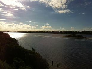 Swan Bay
SWAN BAY
The Swan Bay component of the Port Phillip Heads Marine National Park incorporates Swan Bay to the eastern shoreline of Swan Island, Rabbit Island and Duck Island excluding the shipping channel to the Swan Bay Jetty. Swan Bay is encircled by land except for the two channel openings that connect it to Port Phillip Bay. The land surrounding parts of the Bay is made up of low hills. When it rains, water flows off these hills into the Bay. This source of fresh water is important to the survival of animals and plants living in the Bay.
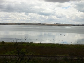
Most of the Bay is shallow. It is sheltered from the winds and you rarely see waves. The currents in Swan Bay are weak. The bottom of the bay is made up of a mixture of mud, shell grit and sand.
If you canoe across some parts of Swan Bay you might notice a pattern of troughs and shallows. These were created by dredgers who pulled up shell grit from the site in the 1960s and 1970s. This mining, together with other farming practices, allowed Swan Bay to develop into a modified wetlands complex.
Swan Bay contains extensive paddocks of seagrass. During low tide these seagrass beds are exposed. These beds are important feeding grounds and nursery habitats for many species of fish and birds, especially migratory birds. As such, Swan Bay is listed as a RAMSAR site which means it is a wetland of international importance.
For more information, please go to: http://parkweb.vic.gov.au/explore/parks/port-phillip-heads-marine-national-park/things-to-do/swan-bay
The Swan Bay component of the Port Phillip Heads Marine National Park incorporates Swan Bay to the eastern shoreline of Swan Island, Rabbit Island and Duck Island excluding the shipping channel to the Swan Bay Jetty. Swan Bay is encircled by land except for the two channel openings that connect it to Port Phillip Bay. The land surrounding parts of the Bay is made up of low hills. When it rains, water flows off these hills into the Bay. This source of fresh water is important to the survival of animals and plants living in the Bay.
Most of the Bay is shallow. It is sheltered from the winds and you rarely see waves. The currents in Swan Bay are weak. The bottom of the bay is made up of a mixture of mud, shell grit and sand.
If you canoe across some parts of Swan Bay you might notice a pattern of troughs and shallows. These were created by dredgers who pulled up shell grit from the site in the 1960s and 1970s. This mining, together with other farming practices, allowed Swan Bay to develop into a modified wetlands complex.
Swan Bay contains extensive paddocks of seagrass. During low tide these seagrass beds are exposed. These beds are important feeding grounds and nursery habitats for many species of fish and birds, especially migratory birds. As such, Swan Bay is listed as a RAMSAR site which means it is a wetland of international importance.
For more information, please go to: http://parkweb.vic.gov.au/explore/parks/port-phillip-heads-marine-national-park/things-to-do/swan-bay
FRESH WATER CREEKS
The Borough has fresh water sources: Yarram Creek and Frederick Mason Creek.
These creeks support a variety of fresh water organisms and plants.
Several fresh water catchment areas around the Borough run into Swan Bay. The health of these catchment areas can affect the health of Swan Bay and impact on the Bay's ecosystems of the bay. A catchment is an area of land where rain water collects. When it rains, the water flows down the hills surrounding Swan Bay before finding its way into the Bay itself. Some of this water goes underground and will continue to slowly flow into the Bay during the following weeks.
For more information, please see:
http://parkweb.vic.gov.au/__data/assets/pdf_file/0003/313374/Port-Phillip-Heads-Marine-National-Park-Management-Plan.pdf
